
River History and Photographs
The Duwamish River and the land around it has a rich history. It has been a central part of what is now South Seattle’s ecosystem for thousands of years, first being used by Native Americans for transportation, fishing, and shellfish harvesting. Long after settlers arrived in 1850, the river was dredged and straightened in 1913, giving a place for industry to move in and shape modern Seattle.
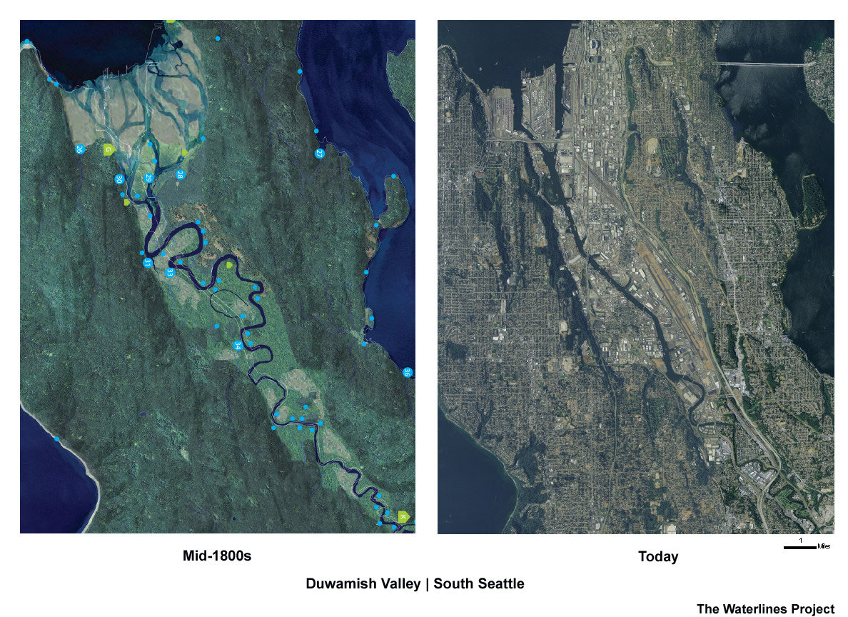
Above: A comparison of the original meanders of the Duwamish River to its shape after straightening.
Image: Burke Museum blog (Waterlines Project)

Above: The results of the straightening and dredging of the Duwamish River, 1922.
Image: Burke Museum blog (File Photo / The Seattle Times)

Above: Photograph of a diver on the Duwamish, 1924.
Image: Courtesy of Seattle Municipal Archives, item no. 50066

Above: Aerial shot of the Duwamish River with the First Avenue South Bridge in view, 1955.
Image: Courtesy of Seattle Municipal Archives. item no. 130312

Above: The industrial district with the Duwamish River in view, 1990.
Image: Courtesy of Seattle Municipal Archives, item no. 111697

Above: Industry along the Duwamish River, South Park Bridge in view, 1987.
Image: Courtesy of Seattle Municipal Archives, item no. 102542

Above: Recent photograph of a multilingual sign warning about the safety of consuming fish caught from the Duwamish River.
Image: Duwamish River Cleanup Coalition

Above: Aerial shot with Harbor Island, the Duwamish River, the industrial district, and Seattle’s skyline in view, 2001.
Image: Courtesy of Seattle Municipal Archives, item no. 123593